Last Friday Tim, Brian, Trey and I headed south from Boulder towards Leadville after work with hopes of hiking Mt. Massive's standard trail, the East Slopes route. Massive is the 3rd highest peak in the lower 48, below only Mt. Whitney in CA and CO's highpoint, Elbert (Massive's neighbor to the south). Given our time constraints, logistics, etc. Massive seemed like a good choice. On the drive down we worked our way backwards from a hard deadline of 4pm return to Boulder after hiking to determine we needed to be back to the trailhead by 1pm at the very latest. With 7 miles of hiking each way to cover, we needed to start as early as possible and run whatever portions of the trail that we could. With that in mind, I left the boots in the car and opted to go as light as possible, with trail running shoes at the ready. Having never run a long distance at 10,000' or 13,000' of elevation, I was curious to see what my legs and lungs were capable of. I have been running/riding/training much more this year than previous summers, so my legs and lungs are probably in the best shape of my life, which gave me a glimmer of hope. I thought it would be possible, but still realized this was not going to be like any other 14er I had attempted before. A new spin on the same old thing, if you will... making class I and class II hiking a bit more interesting... It was going to be a physical challenge and a race against the clock. We found a nice campsight within a mile of the trailhead and set the alarm for 5am.
At 6:05 we set out from the trailhead on the Colorado Trail at approx. 10,100' of elevation. I had to stop almost immediately for my morning ritual... bummer. I guess it's good that I have a body you could just about set your watch to for certain biological actions, but this was a bit annoying to say the least. Once I caught up to the group again, we began trail running. In hindsight, I think the first mile is the steepest of the 7 miles, which is bizarre given the Colorado Trail is usually gentle and flat. This did not bode well for my chances of keeping up with the group. Luckily, however, after the first mile the trail flattens or even descends, so I took advantage of that wherever possible. Despite the downhill/flat, those first 3 miles gain roughly 1,000' of elevation. I was very relieved to come upon creek crossings which ostensibly mark miles 2 and 3, and made it to mile 3 in about 55 minutes, apparently only just a few minutes behind the rest of the group. It generally takes my body much longer to get warmed up than Trey, Tim and Brian, so I was happy to have not slowed them down too much at that point.
We took a quick break for breakfast and then continued another minute or two to the split where we left the Colorado Trail. From there the trail becomes a soft dirt/pine needle mix for a few minutes until you reach treeline and find a soft muddy trail weaving through willows up to Point 12,466' that marks the final shelf, beyond which the Massive trail becomes a fairly steady grade up to the saddle at 14,000'. We took breaks every once in a while to eat and apply sunscreen, but we were all happy to find the trail fairly soft and consistent - i.e. able to be run on the way down. I was also happy to discover what time it was every time we stopped... I kept thinking it would be an hour or more later than what Trey told me, so I was happy to hear we were on pace to make our 1pm cutoff. At roughly 13,500' I began to feel the effects of altitude in the way of slightly sore legs (from the trail running) and typical shortness of breath. The sight of the other 3 guys ahead of me pushed me on, quicker than I would have normally gone without time constraints or faster party members. Altitude didn't slow me down too badly, and I was on the summit at 9:30. That was definitely my earliest 14er summit yet. I was happy to have done the first 7 miles in 3:30 including all breaks, and felt very confident we could make it down in time even if only walking.
I didn't stay on the summit very long despite perfect weather. At 9:45 we turned around towards the saddle, where we hoped to start running from. I don't know exactly what happened, but I stopped to tie my shoe in preparation for running and all of the sudden could not see anybody else in the group. Eager to catch up, I took off, discovering that perhaps trail running 14er descents is the best way to do them... my knees felt great, and it was simply a matter of letting my legs do what they wanted to do without halting momentum. I had only to spot my next foot plant, and the rest was fairly natural. My legs and lungs felt great when I finally caught up to Trey and Tim, who had stopped to wait for me at treeline. We all commented that the trail was really good for running, and noted that although there were some uphill stretches in the trees below us, the soft trail would be very manageable for the last 3 miles. With 11 miles on my legs already, I definitely began to tire, and was forced to walk some sections - even downhill - in the last two miles. I knew Brian was way ahead of me, though, and would be ready to hit the road as soon as possible to prevent arriving at DIA late. I kept this in my mind, and walked as little as possible. There came a point where walking hurt as bad or worse than running, so I just kept running. By that point it was as much of a mental challenge to push on, so I was happy (in a slightly sadistic way) to get to the point where my mind forced my body to go beyond typical limits... good practice for the future, I think.
After being flagged down by a guy who had questions about the trail (hoping to make my same trip on his own tomorrow) just a few hundred yards short of the trailhead, I made it back from the summit in 2 hours flat. All told, I had gone 14 miles in 5 hours and 45 minutes, including bathroom/food/summit/blister maintenance breaks. For comparison, it took me 11 and a half hours to hike the 15 miles that Longs Peak required a few summers ago. Needless to say, I was happy with the performance. We dunked our feet in the river by the trailhead and were on the road before noon, a full hour ahead of schedule. While I still don't consider myself a good runner, I feel like my legs are getting stronger and know for certain that my lungs are continuing to get into better shape. Here's hoping that trend continues in preparation for the next physical challenge...
The few pictures I did get are available at
http://www.flickr.com/photos/brett_burch/sets/72157624417086953. Enjoy.
Showing posts with label 14er. Show all posts
Showing posts with label 14er. Show all posts
Saturday, July 24, 2010


Monday, July 5, 2010
July 3rd Blanca / Ellingwood attempt
On Friday myself, Brian and Trey headed south to start the long Independence Day weekend by heading to the Blanca massif to climb two of the Sangre de Cristo range's 14ers; Ellingwood and Blanca. Driving into the town of Blanca (and for miles before/after), the Blanca massif looms enormously and intimidatingly above the dry valley floor. I really can't say enough how different it is to approach a mountain like Blanca or even Princeton (where the entire massif has such great relief) than a mountain like Bierstadt, for example. After some slight confusion around whether we made the turn onto the correct dirt road, and honking to move cows, we started up the infamous "road" with a few hours of sunlight remaining. Ultimately I was not up to the challenge and stopped the Jeep well short of where we probably could have made it before the road would have been too much for El Jefe. Regardless, with only about 90 minutes of light remaining, we hoped we would make it the remaining 3 miles to Lake Como... After locking the Jeep and actually hiking to a campsight for the first time since moving to Colorado, we shouldered our backpacks and made it about half way, stopping at a vacant campground in an aspen grove at the final crest of the road before it becomes more than something a stock 4WD SUV could handle. I was fairly spent. It's amazing what simply adding a tent, sleeping bag, and sleeping pad will feel like on your back.... not as bad as skis, but still heavy. I also hadn't really planned on hiking very far, and hadn't eaten/drank anything in preparation for the hike. [Note to self, don't take approaches for granted.]
After dinner and a fire with clouds rolling in, we went to bed. We got rained on fairly hard in the night and woke up at 5am for a 6:05 departure time. It was almost funny hiking the first mile or so beyond our campsight. If we had known the road was flat or even downhill from where we stayed, we might have continued the night before, but nowhere we passed was as good as where we stayed for two tents, and the light was running out on us, so I think it was best that we stopped where we did. Lake Como road is historically interesting. Along the way you pass sections of road where people have died trying to drive over one rock form or another (including old Jeep parts downhill from said accident site) and old mining homesteads along the creek. We made it to the lake in 80 minutes; I was last to make it after having stopped several times for photos along the road. The setting at Lake Como is really awe-inspiring... Little Bear Peak looms above Lake Como, with trout in it and bear nearby. At some point I wouldn't mind just hanging out by that lake for a whole weekend. It was also the setting for a Jeep commercial; no other vehicles made it to the lake while we were there. You can't just drive up to Lake Como in your 4Runner, take a few photos, and drive on like you can with Mt. Evans. I like the Blanca massif for the same reason I liked hiking Longs Peak; you have to earn it in just about every way.
Beyond the lake, the road dissipates into a trail near a waterfall. By the time you climb above the waterfall, you're surrounded on all sides by ramparts defending nearby peaks and you hike past lakes full of ice... in July. The scenery evoked a sense of seclusion and challenge, and the hike changed to a climb, much like Castle last September. This was more than simply following a trail up a big mound. I really liked it. It was actually somewhat daunting, and the photos do not do justice to what you see there. By that point, I was super excited about the day and being able to prove to myself that I could take on harder and more remote peaks, as well as the possibility of achieving 1/3 completion (this would make 18/54) of Colorado's 14ers... it seemed merely a matter of time before post-climb beers were in order. However, looking above us and down the valley back to the desert, it became obvious that our weather window was rapidly shrinking. At 9am, after stopping and debating several times about course of action, we turned around. We were at 13,000' right below the Crater Lake ledges/waterfall, with several hours before noon... but clouds had built up in the valley and rolled up to right above us. Literally no more than 300' above us another party was surrounded by clouds. I believe if there had not been clouds, we would have made great time and made it to the top of both Blanca and Ellingwood, but it simply wasn't in the cards for us. To be honest, it was very frustrating and difficult to accept turning around. I've had to turn around or not attempt before due to vehicle issues or another person in the party being unable to continue... both those times were easier to accept. It was nothing we did to ourselves; it was beyond our control. We knew there was rain in the forecast, had been rained on the night before, and did not see any possibility of the clouds burning off. By the time we made it back to Lake Como, the peaks were relatively free of clouds, and it seemed like a nice clear day above us. That being said, however, it was a good lesson learned, and I would make the same decision again. When it comes to lightning, I would rather make the wrong safe decision than the wrong dangerous one. But still...
We made our way back down to the previous night's campsight, packed up wet tents and hiked back to the Jeep. It was a much less stressful drive out... something about gravity, I think.
Given the long weekend and the opportunity to reflect on recent events, I've started to wonder and/or realize a few things about myself.
After dinner and a fire with clouds rolling in, we went to bed. We got rained on fairly hard in the night and woke up at 5am for a 6:05 departure time. It was almost funny hiking the first mile or so beyond our campsight. If we had known the road was flat or even downhill from where we stayed, we might have continued the night before, but nowhere we passed was as good as where we stayed for two tents, and the light was running out on us, so I think it was best that we stopped where we did. Lake Como road is historically interesting. Along the way you pass sections of road where people have died trying to drive over one rock form or another (including old Jeep parts downhill from said accident site) and old mining homesteads along the creek. We made it to the lake in 80 minutes; I was last to make it after having stopped several times for photos along the road. The setting at Lake Como is really awe-inspiring... Little Bear Peak looms above Lake Como, with trout in it and bear nearby. At some point I wouldn't mind just hanging out by that lake for a whole weekend. It was also the setting for a Jeep commercial; no other vehicles made it to the lake while we were there. You can't just drive up to Lake Como in your 4Runner, take a few photos, and drive on like you can with Mt. Evans. I like the Blanca massif for the same reason I liked hiking Longs Peak; you have to earn it in just about every way.
Beyond the lake, the road dissipates into a trail near a waterfall. By the time you climb above the waterfall, you're surrounded on all sides by ramparts defending nearby peaks and you hike past lakes full of ice... in July. The scenery evoked a sense of seclusion and challenge, and the hike changed to a climb, much like Castle last September. This was more than simply following a trail up a big mound. I really liked it. It was actually somewhat daunting, and the photos do not do justice to what you see there. By that point, I was super excited about the day and being able to prove to myself that I could take on harder and more remote peaks, as well as the possibility of achieving 1/3 completion (this would make 18/54) of Colorado's 14ers... it seemed merely a matter of time before post-climb beers were in order. However, looking above us and down the valley back to the desert, it became obvious that our weather window was rapidly shrinking. At 9am, after stopping and debating several times about course of action, we turned around. We were at 13,000' right below the Crater Lake ledges/waterfall, with several hours before noon... but clouds had built up in the valley and rolled up to right above us. Literally no more than 300' above us another party was surrounded by clouds. I believe if there had not been clouds, we would have made great time and made it to the top of both Blanca and Ellingwood, but it simply wasn't in the cards for us. To be honest, it was very frustrating and difficult to accept turning around. I've had to turn around or not attempt before due to vehicle issues or another person in the party being unable to continue... both those times were easier to accept. It was nothing we did to ourselves; it was beyond our control. We knew there was rain in the forecast, had been rained on the night before, and did not see any possibility of the clouds burning off. By the time we made it back to Lake Como, the peaks were relatively free of clouds, and it seemed like a nice clear day above us. That being said, however, it was a good lesson learned, and I would make the same decision again. When it comes to lightning, I would rather make the wrong safe decision than the wrong dangerous one. But still...
We made our way back down to the previous night's campsight, packed up wet tents and hiked back to the Jeep. It was a much less stressful drive out... something about gravity, I think.
Given the long weekend and the opportunity to reflect on recent events, I've started to wonder and/or realize a few things about myself.
- It was good to know that I can make myself turn around due to weather. It was pretty ominous when we made the call, and it cleared up quickly, but it was good to have been able to do it rather than pushed on only to regret it later.
- I will (hopefully?) never stop enjoying merely hiking in the mountains, but it seems lately that I am curious to try more difficult routes up 14ers. For example, I want to ascend the Bell Cord when I make it to the Bells. I want to take routes that require more thinking than "follow the obvious foot path..." to the top. Don't get me wrong; even merely hiking a 14er takes a great deal of energy, preparation, mental stamina, etc... but after having done that 15 times, I want to push myself a little bit more. Even if it just means hiking outside of the easier summer months, I think I'm finally ready both physically and mentally. I also think that it has something to do with getting away from crowds. The view from Lake Como and beyond on Saturday was truly incredible, and seems more so because it must be earned.
- My greatest physical passion of any that I pursue is skiing. I do several things better than skiing, but nothing gives me greater satisfaction. I could ski every day for more days than I care to consider before it became mundane. A lot of my summer activities (especially running... 99% of the time I really hate running, as in, definitely hate, hate with italics) are solely to improve my potential to ski better. I'm not ready physically yet, but similar to the above point, I'd like to ski some 14ers when I am.
- I don't really desire to hike all 54 of Colorado's 14ers just to say that I have hiked them all. I don't really understand that motivation, or at least don't want to associate myself with it. If I am just hiking to be able to add another notch to my brag belt, I'm out there for the wrong reason. I want to climb them in a way that's challenging to me. (Obviously in the first part of the season after having not been at altitude, even the standard routes can be challenging enough, so this does not always exclude standard class 1 or 2 routes.) To that end, I have started to wonder if I shouldn't spend more time in the Indian Peaks nearby, where there are plenty of challenging 12ers or 13er peaks which are more challenging than most 14ers.
Sunday, June 20, 2010
Spring 2010 recap
Spring began with Darren, Brian and I somewhere in central CO heading east on I-70 from Silverton by the skin of my teeth... err, Jeep. Tomorrow is the first day of summer. Let's recap some of the in-between.
- In April and May I got a few more ski days in... notably my first day on my tele's at Ski Cooper, went to Winter Park on my tele's for their closing day, and one last in-bounds day on Loveland's closing day, which turned out to be a decent powder day.
- In April I put my skins on my new tele setup and got completely worked (we made it to the trailhead.... no further), but regardless, I learned a bit about skinning in my would-be attempt to ski the Angel of Shavano.
- In May I spent two Saturdays playing in the Brainard Lakes area; one snowshoeing and one skiing. I have already talked about that here.
- On Memorial Day weekend, dad came out from Ohio to see more of Colorado and get some reprieve from work. We had a very nice weekend together with great weather. I took him on a few of Boulder County's finest back roads, and we both enjoyed. It was a pleasant reminder of how much Boulder County has to offer. After dad flew home, Trey and I put in a great ride at a very moderate pace to Jamestown and back. This was my longest outing on my road bike so far, and really has me looking forward to more long hills on the bike.
- On the first weekend in June, Ryan, Allison and I made it to the top of our first 14er of the year; Mt. Princeton. We camped just above the radio towers on one of the windiest nights I've ever spent in a tent, but luckily had very mild weather for the hike. There was a little snow to cross, but not enough to travel with winter gear. It was a slightly confusing descent, but overall a very nice day. With my first southern Sawatch peak in the books, I was happy to have the season underway. Photos from the outing are available here. I have to admit that I was a bit under-prepared in terms of clothing... I forgot my gloves, which were sorely missed for several stretches during the hike. It's always good to aim low for the first outing of the year to prevent simple mistakes from creating epics.
- Last weekend I flew back to Ohio to see my parents, some friends from high school and college, and to see Phish again at Blossom. I hadn't seen them in 10 years, since before their multi-year hiatus and semi-meltdowns. I had read positive reviews and heard a few of their shows from 2009, and all I can say is WOW. That was my 7th Phish show, and the best one I've seen in person. Show review: http://phishthoughts.com/2010/06/13/blossoming/.
- Yesterday Trey, Brian and I hiked Mt. Shavano and Tabeguache Peak. I think this was probably my most efficient 14er hike yet, and was very rewarding. We camped exactly where County Road 254 intersects the Colorado Trail in one of the most ideal campsights I've ever stayed in, at 9,850'. [Note to self: the Colorado Trail in this part seems like a perfect mountain bike path!] We were awake at 6am and on the trail at exactly 7am. The initial hike to treeline felt fairly strenuous, but was not impossible. I believe we hiked at roughly 1200' of elevation gain per hour, passing everyone we saw except the lady and dog that were training for the Pikes Peak marathon. I'll be the first to say that it is NOT a race, but I felt good being able to sustain the pace that we did, considering Trey and Brian are generally in much better cardio shape than I am. I felt really good the whole day and did not struggle with altitude until ~13,500, and even then it was largely due to my needing lunch that I slowed. Only until we had already summited both Shav+Tab already, and were re-summiting Shav did mental fatigue begin to set in for me. The weather was absolutely ideal until a stiff breeze formed clouds above us on our descent back to the Angel col from Shavano's summit. Happy to be off the ridge, it was a knee-killing descent back to the Colorado trail, but a very beautiful one at that. 10 miles and 5500' of elevation gain doesn't go down easy, but my body feels good today, so hopefully that's a sign I am in good enough shape to handle just about any challenge that comes my way this summer. Photos from the day are here.
--
This time I remembered gloves, but I brought two left gloves! [I have two pairs of the same Black Diamond glove, which I currently cannot remember the name of, but they're lightweight and bomber. I use them year-round for ski gloves, even though they're really just a simple Gore-Tex shell with a fleece liner. People always assume my hands are cold, but the gloves are just amazing.] To fix the problem, I pulled out the liner and turned it inside-out for my right hand. Not ideal, but a perfect fit when needed. Hopefully my next outing I'll have my glove situation all worked out.
Friday, October 9, 2009
making the most of the summer
Alright, now that it's mid-October I can write about mid-July here...
Me voy a Tejas (Wedding #2)
The weekend after Ryan and I got rained out as described in the previous post, I flew to Austin to be in my second wedding of the summer. It was great to be back in Austin, and believe it or not the 104 degree heat didn't get to me that much. In a break from the wedding festivities, I got to see a few friends from a previous job and have wonderful Tex-Mex... not to mention beer with lime in it that wasn't Corona. What a fabulous idea that is.

But back to the wedding... I got to see my sister and new brother-in-law's home during a post-rehearsal open house. It was great seeing family and meeting new faces on the other side of the wedding. For some reason it felt like I hadn't spent that much time with the fam in this kind of setting in a long time, even though a lot of us had spent Christmas together and we had a wedding the previous May. Ahh well... it was good. Real good. We had the rehearsal dinner at Texas Land & Cattle, of course. It was a traditional Cowboy/Western wear themed party, but I showed up in a guayabera shirt, more of a gaucho than a cowboy. (I had tried to pick up some chaps on craigslist but nothing really fell into place.)

I called out a few relatives that I heard had spent a meal at Quizno's or Subway or something unallowable like that. My sister (the bride) thought I was wasted, but my announcement to the whole party to consult me for culinary advice was sincere and sober. Let thee be warned; the food in Austin is way too damned good to bore your taste buds! Don't give in to the national chain!
Wedding day was very hot - 104 - and the wedding was outside in the afternoon. The stage:

I would have preferred it were October, but there was a nice Central Texas breeze blowing in from the Longhorn ranch on the other side of the fence cooling us off. It was what it was, and we had fun. Amazingly enough, despite me being the only remaining single sibling, there was no onslaught of "so when are you getting married?" jeers. Gracias.
It all went way too fast, and I found myself needing to spend the next few weekends doing little of note.
On the Sharp End in Boulder Canyon
On a Sunday afternoon in mid-August Brian and I went up to Boulder Falls to climb Buried Alive, a 3 pitch sport climb on Tonnere Tower. I decided to put up or shut up, and had a fine learning experience in the process. This was only my second lead, and the first multi-pitch lead attempt. I felt confident in putting my skills to the test, and was psyched to have a partner to follow me up. There was a couple starting our intended climb just as we got there, so we decided to start on something else to warm up with. (Feel free to grin and laugh now if you know where this is going.) We chose the route that looked pretty straightforward about 20 feet to the right of the main event. Once I was 30 feet up I realized that the next 30 feet were beyond 5.9, and had a date with an "almost epic..." After backing off the crux of a 5.11 pitch that I couldn't finish (not to mention lead), making use of a nearby tree, downclimbing to try the 10a next door, not realizing I left a draw in the 3rd-to-last bolt on the 11 (that bolt is 2nd from top here, with my tree in the background), and generally doing my best to ignore the sensation of the shriveling of my testicles, I found myself standing on a ledge to anchor in to the top of the 11 but with too much friction in the system to actually pull the rope into the anchors. Brian had loads of slack in the line, but I literally was pulling with all my strength and no budging. The rope is fine and wasn't stuck on anything but it was not happy being clipped into 2 routes at the same time. Too much friction. Lesson learned. I was glad nobody else was watching, or at least I couldn't hear them laughing from the parking lot. Anyways, then Brian gave it a shot and did very well up to the point that he had decided was far enough. Afterward we hit up the main event since our neighbors were coming down p1 of Buried Treasure. I then discovered the enormous and wonderfully pleasant difference between 5.9ish and 5.11ish. I got to the top of p1 and Brian cleaned up after me. We then realized our brains and arms were jello so it was time to rap 95' back to safety.
I would really like to try to finish Buried Treasure, and would also like to try The Twilight Kid again but only as long as somebody can lead it or toprope it for me... ahh well. All in all I was thrilled to have the knowledge and ability to get myself out of a bad situation, then lead at least one pitch, belay my 2nd-er and get us back to the deck via rapping safely. My new rope and draws did their job, so I was happy. At least now I know for sure where my limits lie and can work within them and hope to push beyond them safely in the future.
Muzzurrah Hilltoppin' in the Sawatch
A few weekends later Phish rode into town and tore Red Rocks to pieces, but I didn't have tickets for any of the 4 nights. The best alternative was to get the heck outta dodge and pretend I wasn't missing one of the best weekends they ever put on and hike a 14er. [Seriously, if you haven't heard these shows, get them! In hindsight, I should have ponied up $250 to a scalper to see 7/30. It is a terrific show, a fun cerebral listen, and gives hope that Phish is back to a far superior era than some of the more recent ones. It probably sounds dumb, but it was sooo uplifting to hear them reaching their full potential again. Welcome back boys, I'll see you soon!]
On the last day of July Ryan, Allison, Trey and I headed up Missouri Gulch towards our old friend Winfield and camped on a cold night. On August 1st we summitted Missouri Mountain. I was worried about trip reports mentioning the climb from the trailhead to treeline being a memorable nightmare of switchbacks. To my surprise and satisfaction (and definitely due to the fact that I had begun running/training for an upcoming 10k) I had little problem with this section. I actually could not believe how well I did; the difference was more than enough for my hiking partners to notice. I am usually terrible at ascending steep hills, but was very comfortable all the way up. Once at treeline we noticed there was fresh snow on Belford, a neighboring 14er. [Snow in July! This has been quite a cool and wet summer, to say the least.]
Once in the basin above treeline, the valley opens up and the hike is trivial until you reach the beginning of Missouri proper. Beyond that, there is a fairly serious incline gaining the final ridge, but once you're on the ridge you're home free. The weather was perfect for us, and we probably could have stayed on top for hours if we cared to. I was overwhelmingly satisfied that my lungs were getting in shape, and to see Huron, the first 14er I summited two years prior, from another angle. The central Sawatch aren't the most challenging mountains in the state, but they offer great views and a great excuse to get outside! Here is the obligatory evidence:
Wedding #3
The next weekend I borrowed a coworker's condo in Frisco and found myself back in the mountains. This was the third wedding of the summer for me, Tony and Shelly's, atop Keystone. This was yet another wonderful weekend in the hills, spent relaxing and enjoying the company of college friends. Before the wedding Ryan and I took his kayaks out on Dillon and had a nice time on the water. After that it was off to Keystone to ride the gondola to 11,000', sunglasses mandatory, with Quandary as the backdrop to the bride and groom's big day.
This comment is in no way an attempt to take away from any of the other weddings I have attended, but seeing Tony and Shelly together was very moving. They truly were the most excited couple I had ever seen walk down the aisle. Tony cried and Shelly glowed... that was pretty much the only way I could describe it. Maybe I shouldn't say any more. It was just really moving. I hope one day to have that same experience.
You gotta run like an Antelope, outta control!
I spent the better part of August and September gradually increasing my running distance to over 6 miles at a 10 minute mile pace to run a 10k section of the Boulder Marathon. Again, historically my cardio has been terrible, so agreeing to run a leg of a marathon was not something I necessarily jumped at when the opportunity presented itself. I did look at it as a way to improve my health (mental and physical) and to prove to myself that I actually could run that distance, regardless of the pace. Averaging a 10-minute mile is hardly worth getting CNN on speaker phone for, but it was what my body would consent to, so I was happy to take what it would give. I finished my 6 miles in about an hour, as expected, and wasn't too sore afterwards, so I can't really complain, but to be perfectly honest I was disappointed with my time. I had trained at a faster pace and hoped for the race to be my best pace yet. This was likely due to the fact that I started running unprepared and with a full bladder, forcing me to stop to use a porta-pot before starting my 5th mile. That was a mistake, to say the least. I guess I'll have to run the Bolder Boulder next Memorial Day and improve :) All in all, it was a goal accomplished and a pat on the back for my lungs to have allowed me to run at all, so I was thankful for the opportunity and look forward to the next one. Handing off the ankle RFID to my teammate to finish the race I thought back to when I first moved to Boulder and how I probably couldn't have run 2 miles without being completely winded. I suppose it's true that sometimes you need to look behind you to see where you've been and appreciate how far you've come...

Now that the race is over, I'll probably try to improve my time over shorter distances (maybe starting with 3 miles, for example), but either way I've been keeping up the running. It's funny what wanting to be in good shape for ski season will make you do... and speaking of, it's currently snowing right now, so ski season isn't too far away! Snow, baby, snow. I am seriously driven to not let my lungs keep me from ascending a 14er couloir and skiing down it, so hopefully I'll continue to improve until I really need it in the spring.
Tuesday, September 22, 2009
making the most of the rainy season, part III
Wow, it has been a long time since I have updated here... If I remember correctly, there is still much to tell about the rainy season, so here goes.
In early June I bouldered a bit on Mt. Sanitas right outside of Boulder. It was the first time I had really spent much time on Sanitas, and I have to say it surprised me. Maybe I wasn't in the beginner area, but I definitely thought the climbing would be easier. I've heard about tons of V0/V1 problems but didn't find too many when I was there. It was really busy but the rock was much kinder on my hands than Flagstaff is though, so it's a nice little outing in its own right.
A few weeks after Sanitas, I took a spur of the moment long weekend to the Telluride Bluegrass Festival. I went with the same friend I took up to Sanitas. We left Boulder on Wednesday after work and had what basically equates to 5 days of ridiculous debauchery in one of the most incredible settings on the planet. Let's just say that if there ever was a weekend where I put on a good Hunter S. Thompson impersonation, this, dear friends, was one of a select few, hence the leaving out of several details here. Before leaving Boulder we stopped at Liquor Mart for provisions, leaving town with a handful of bottles of beer, a 1.75L bottle of wine, a bottle of vodka, and two 12 packs of canned beer. Wednesday night we drove as far as we could before I started to get spooked of driving with all the deer on the side of the road. We got to Monarch Pass, where it was still very cold and snow was in our campsight. (Nothing like a little alcohol to take the chill out of the air...) We took our time getting going and got into Telluride around noon on Thursday. I hadn't been back to Telluride since I was a boy (middle school?) so this was a very nice reunion. The San Juans were simply stunning, with tons (tons!) of snow still on them. Most of the first day was spent drinking and unloading the Jeep while we set up our camp, finally seeing a few shows, and then head back to camp only to fall asleep and ultimately miss David Byrne's headline of the night. We made friends anyways, and ultimately did not go back to bed until the sun was coming up over the mountains. We slept under the dawn/stars and woke up to begin drinking again. We had a few beers for breakfast (which became the norm of the weekend) before we headed into town for the shows. We danced all day and I got a pretty good sunburn on my feet. That night Béla Fleck & Toumani Diabaté were definitely the highlight show of the weekend for me.

Every act we saw was fantastic though... it got to the point where I would stop checking the schedule, because it simply did not matter who was playing. Every band I knew put on a great show, and every band I didn't know encouraged me to check them out when I got home.
Saturday we woke to a completely different cold and rainy setting, so we headed into town for shelter... not to mention we had run out of beer. We reloaded at a nearby gas station and then headed to the bars. Most of the bars in town were packed, but we managed to find a corner where we watched an incredible dance-off by two of the drunkest people I've seen in recent memory. Ex:

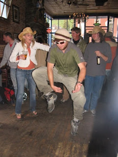 We made our way back to the stage for Yonder Mountain, who were terrific as always, and during which I ran into another Boulderite... small world. The rest of the lineup that night was incredible, with Gaelic Storm capping roughly 10 hours of dancing. My legs were tired, and I was bummed going to bed because Sunday meant a long drive home back to responsibility. The 3am quesadillas helped ease the pain though :) Sunday we caught the first two shows, packed up our tent and headed back to Boulder. I was bummed we had to leave before Emmylou Harris played, but I knew we had to. We went home via I-70 instead of 285, and that made a truly wonderful Tour de Colorado. Photos of the weekend can be found at http://www.flickr.com/photos/brett_burch/sets/72157620431813195.
The weekend after Telluride Ryan, Allison, Brian and I hiked up La Plata via the Southwest Ridge. Ryan and I got our revenge after last year's Jeep-sinking 4th of July incident. It was our first new 14er of the year, and a lot of fun, although (this is the rainy season, after all) we did get rained on and had some nearby lightning. We actually ended up removing our packs to run quickly to the summit and claim our prize before a quick descent. I was happy to have made it down fairly dry, but will try to not cut it so close with the weather in the future. Photos of the outing are at http://www.flickr.com/photos/brett_burch/sets/72157620702598064/.
Lastly, Ryan and I tried to climb on 4th of July weekend in Boulder Canyon and got rained out. As soon as we reached the crag after some trailhead-finding troubles the clouds let rip with rain and lightning nearby. It looked something like:

I was happy just to head into town for some time at The Spot. The 4th of July truly seems cursed for us.
Thus concludes the rainy season. Bring on the snow season!!
Friday, July 3, 2009
making the most of the rainy season, part II: Tuning Fork couloir
After my hiatus mentioned at the end of the previous post, on May 30th I decided to employ my ice axe, crampons, and Avy 1 class lessons in an attempt of my first day of backcountry skiing (aside from the field trip in the avy class). I joined a coworker on his annual outing up to Torrey's Peak, a Front Range 14er which I've summited in the summer. Instead of the route from Steven's Gulch, we headed up Grizzly Gulch to Tuning Fork couloir with the objective of skiing the same route ascended. I felt safe knowing that both guys I was going with had done the exact route previously, that the season was getting late enough to have a nicely consolidated snowpack, and that we had an easy emergency bailout possible by simply clicking in and pointing downhill.
We all had beacon / shovel / probes just in case, but to be honest, my bigger concern was whether my cardio would allow me to keep up with guys in much better shape than I. My disadvantage was exaggerated by not having an AT or tele setup, so I climbed in mountaineering boots with both my alpine skis and alpine boots on my back instead of just wearing my ski boots for the climb (... let's just say that I am now acutely aware that my alpine boots weigh 10 lbs). I was extremely excited but in all honesty, because of this, I had really low expectations of actually making it to the top and was resolved to be content with however the day turned out.


We left Darren's house in Golden around 5:15am and headed towards the Bakerville exit. Rob's Land Rover made quick work of the 4WD road, and we hit the trail with clear skies. After a little bit of routefinding, stream crossing, and postholing, we made it to the steeper section where you gain the bench that is effectively the apron of the couloir. Apparently I hadn't eaten enough for breakfast, because in between the time that we put on our crampons and reaching the top of the bench (just a few minutes) at ~11,400' my stomach dropped and I was completely out of steam. I started in on my lunch before starting the couloir (and the climb in earnest). After a few minutes' delay, I was off, trailing behind Darren and Rob but making progress.
I got into a decent rhythm of "plant ice axe, step, step, repeat" and slowly formed the opinion that this was the true way to fully experience a mountain.
After a while clouds started to roll in, and it seemed like making it to the top would not be possible. We pressed on knowing that a quick getaway was easy, but apparently only averaging about 500' elevation gain / hour. In the end this proved too slow, and we were turned around somewhere around 12,600' having climbing only about halfway up the couloir. As the graupel began to fall, we moved skis from packs to feet and headed down. I hadn't realized how exhausted I was until I tried to make a few turns. My legs were absolute mush. (Note to self: leave enough gas in the tank to be able to let 'er rip next time.) I made it down OK, but wasn't able to fully enjoy the descent because of the condition of my legs. Darren's video of me tells the tale... embarrassing. If I had been fresher, those may have been my funnest tracks yet... they were easily my hardest earned ones. I will definitely be returning to complete the journey in seasons to come.
Hopefully without putting too much emphasis on these points, I'd like to also point out that I personally consider this a foray into more legitimate mountaineering (I don't really count the glissade of Cristo couloir), as well as a deviation from previous 14er outings where the main objective was the summit. I was climbing on this occasion not primarily to make it to the top, but to reap the rewards of the climb on the descent. I wasn't hiking to the top to check a mountain off of a to-do list. (I had already been to the top of Torrey's, after all. I've talked to this before, so I won't dwell...) I'm not about to suggest that all my previous 14er outings have been boring aside from the summit photo (completely the opposite), but still, this day seemed like a progression in my mountain experience, or whatever you want to call it, and it felt very good. The climb was extremely interesting in its own right, and wasn't just a means to an end. I was thrilled to be using my axe and crampons instead of following a train of backpacks up a relatively straightforward trail. What little couloir kool-aid the day provided was more than enough to plant the seed for an addiction to climbing couloirs and skiing them... or getting off-piste turns at the very least.
This was one of the most rewarding days on a 14er I've had, despite not summiting. I re-learned that eating, timing of nutrition, and mental clarity are hugely important in these kind of outings. I have also officially decided to do something about my crappy lungs. I'm not going to allow myself to just be the slow one in the group anymore. If I am serious about intense exertion at high altitute, I need to get my lungs in better shape, and so I will. My photos of the outing are at http://www.flickr.com/photos/brett_burch/sets/72157618945111321.
Sunday, October 19, 2008
Mt. Evans (14er #10, Front Range finisher)
Yesterday Ryan and I finished our first ascents of the Front Range 14ers by going up Mt. Evans from Guanella Pass. For those not familiar with Colorado, Mt. Evans has a paved road to the top, but with the road closed for the winter we hoped to avoid the zoo scene we found on Pikes last summer. That goal was definitely accomplished (we were the only ones on top once we made it), as was reaching the summit (and more importantly, successfully descending to the Jeep). We also extended our streak of never being denied a summit when attempting just the two of us (doesn't include getting the Jeep stuck for La Plata, where we didn't even set foot on the trail). I wouldn't give us any style points though... due to the willows, a steady diet of ice cream, a steep gully and a fair bit of class 2 scrambling, we barely beat dusk getting back to the Jeep(!).
I had read and heard nightmares of "those awful willows" and thought we would have a solid freeze / snow to our advantage. [Me: "Yay, there will be a well defined trail on snowpack through the willows!" Willows: "Haha, sucka, you still screwed!"] It turned out that although we weren't sinking knee-deep in mud and getting into turf wars with beavers, we did end up doing a fair bit of route discovery and willow-wrestling. It seemed at times we were following tracks of folks who had no better idea of where to go that us, as was probably the case. I am really surprised that there isn't a better marked or official trail through that mess, because it increases the difficulty by an order of magnitude (if such a thing is possible, but I'm pretty sure I just made that up). At any rate, this hike seemed like it had 4 phases (which may fit since it's about 4 miles each way):
Enough ranting. We did have several high points to speak about on this occasion.
Photos: http://flickr.com/photos/brett_burch/sets/72157608181341572/
I had read and heard nightmares of "those awful willows" and thought we would have a solid freeze / snow to our advantage. [Me: "Yay, there will be a well defined trail on snowpack through the willows!" Willows: "Haha, sucka, you still screwed!"] It turned out that although we weren't sinking knee-deep in mud and getting into turf wars with beavers, we did end up doing a fair bit of route discovery and willow-wrestling. It seemed at times we were following tracks of folks who had no better idea of where to go that us, as was probably the case. I am really surprised that there isn't a better marked or official trail through that mess, because it increases the difficulty by an order of magnitude (if such a thing is possible, but I'm pretty sure I just made that up). At any rate, this hike seemed like it had 4 phases (which may fit since it's about 4 miles each way):
- the willows
- the gully (far easier than it looks)
- exiting the gully and bonking before lunch
- scrambling about a mile to the summit
- enjoy a familiar view (having driven to the top several times)
- scrambling back to the gully
- running out of water
- descending the gully with tired legs
- getting horrible cottonmouth (note: eating snow doesn't help much)
- trying to keep up with Ryan while we both race the sinking sun
Enough ranting. We did have several high points to speak about on this occasion.
- There were far fewer people on the trail than last summer's Bierstadt outing. We kept commenting on how quiet it was, which was nice.
- We saw a very beautiful alpenglow sunset on our way back to the Jeep.
- We saw more wildlife than we have on previous 14er outings, including 3 Bighorn sheep, 3 mountain goats, and 2 foxes. (I'm pretty sure the 2nd fox, which we saw within eyesight of the Jeep on the return, actually spoke to us and welcomed us back to the trailhead... then again, I could have been hallucinating.)
- We also completed our first range on the 14ers to-do list, which was a nice milestone. We have yet to set foot on a San Juan, Elk, or Sangre de Cristo range 14er summit, but hopefully there will be days ahead for that.
- We completed our first 14er in the month of October. (October now joins June, July, and August for that distinction.)
- Personally, I also put my new mountaineering boots, Scarpa Triolets, through their first day and they passed with flying colors. They kept my feet dry, blister-free, and warm all day long. I'm excited to use them for hopefully many snow hike/climbs in the future.
- The views of Bierstadt and the Sawtooth ridge were very nice.
- We camped at a great spot Friday night well below treeline on the south side of the pass in Park county.
- The weather was ideal.
Photos: http://flickr.com/photos/brett_burch/sets/72157608181341572/
Sunday, August 17, 2008
Mt. Elbert - 14er #9, state highpoint #5
This weekend was an interesting one. I was able to spend another night in a tent this year, and to summit my 3rd 14er this year (9th overall). But perhaps more interesting is the fact that this weekend brought the first snowfall of the 2008-09 season! Winter is coming soon to the high country! But let's not get ahead of ourselves... the objective of the day was Mt. Elbert via the East Ridge (South Elbert trail), the highest mountain in Colorado and 2nd highest in the lower 48.
Saturday night me and 11 other folks from the Boulder/Denver area camped at Whitestar Campground overlooking Twin Lakes. We drove up from Boulder through everything from sunny skies, pouring rain and snow. At the campsite the weather seemed to change every 5 minutes, and Elbert was shrouded in clouds to the point where I thought our chances of summiting were slim at best. We could, however, see a ways up Independence Pass, and La Plata was clear most of the night. It was interesting to see (with the help of the full moon) the clouds concentrating in between peaks, then breaking up, then repeating. As we went to bed it started to rain with lightning nearby. Ryan and I discussed the idea of hiking in the rain and both felt it would be somewhat refreshing to have a hike where the elements played a factor in our decision making, ability to summit, etc... although the view would not be the same with clouds. I guess this makes sense, but it still seems worth mentioning that this weekend's weather was almost identical to the same weekend last year on Grays and Torreys. At any rate, after I fell asleep the rain apparently turned to freezing rain, but we woke up to clearing skies.
I think everyone was awake by 6:30, but I don't think we started our adventure until around 8:00 with Tim waiting for us about 1.5 miles below the official trailhead. We ended up hiking about 5.5 miles each way, for an 11 mile outing. Despite the 4000+ ft elevation gain, I think the South Elbert trail was the least steep trail I've head on any of my 14ers so far. We started well below the treeline and hiked through aspen groves past several nice campsights on our way up to the ridge. The topo (yep, the lesson from "the La Plata incident" was a good one!) also came in handy at one intersection. [Note: bear right where the road splits and the left fork heads steeply into the trees past a lake to your left.] There were a few steep hills getting to the ridge (enough to get me down to a short sleeve shirt despite temps in the low 40s), but once we gained the ridge the trail eased quite a bit and the elevation/lung conditioning was the only factor separating hikers. Just before treeline the humidity, grass, flowers, and sparse evergreen cover reminded me of balds of TN, WV or VA with an almost comforting sense of déjà vu.
Our group naturally separated into sub-groups of 4, all summiting by 12:30. I felt like we made pretty good time considering about half of us were first-timers. I was pleased everyone that started made it to the top. The view was less than optimal, but the clouds broke apart enough for me to notice the basin between Elbert and Massive seemed worth exploring later. We could also see the south ridge of Elbert still had quite a bit of snow, with a stubborn (and probably permanent) cornice guarding some nice ski lines. This was the first 14er summit I've ever been on where I couldn't see at least one other 14er summit, and also continued the trend of snow on every 14er trail I've been on this year. I didn't stay on top long, as the clouds were closing in on us.

The weather on our descent varied from sunny and clear to whiteout... and changed quickly. At one point I stopped (convinced the snow was over) after whiteout followed by strong sun to take off my shell and fleece only to find that in the time I took off my pack and jackets I was getting snowed on again. If nothing else, it was good motivation to get back to the Jeep before it started raining very hard. I think everybody felt the downclimb in the same way, and we were a tired bunch driving east tonight.
By summiting Elbert, Colorado also now joins Ryan and my list of 5 state highpoints, which also includes Tennessee, West Virginia, Maryland, and Pennsylvania.
Evidence:
Saturday night me and 11 other folks from the Boulder/Denver area camped at Whitestar Campground overlooking Twin Lakes. We drove up from Boulder through everything from sunny skies, pouring rain and snow. At the campsite the weather seemed to change every 5 minutes, and Elbert was shrouded in clouds to the point where I thought our chances of summiting were slim at best. We could, however, see a ways up Independence Pass, and La Plata was clear most of the night. It was interesting to see (with the help of the full moon) the clouds concentrating in between peaks, then breaking up, then repeating. As we went to bed it started to rain with lightning nearby. Ryan and I discussed the idea of hiking in the rain and both felt it would be somewhat refreshing to have a hike where the elements played a factor in our decision making, ability to summit, etc... although the view would not be the same with clouds. I guess this makes sense, but it still seems worth mentioning that this weekend's weather was almost identical to the same weekend last year on Grays and Torreys. At any rate, after I fell asleep the rain apparently turned to freezing rain, but we woke up to clearing skies.
I think everyone was awake by 6:30, but I don't think we started our adventure until around 8:00 with Tim waiting for us about 1.5 miles below the official trailhead. We ended up hiking about 5.5 miles each way, for an 11 mile outing. Despite the 4000+ ft elevation gain, I think the South Elbert trail was the least steep trail I've head on any of my 14ers so far. We started well below the treeline and hiked through aspen groves past several nice campsights on our way up to the ridge. The topo (yep, the lesson from "the La Plata incident" was a good one!) also came in handy at one intersection. [Note: bear right where the road splits and the left fork heads steeply into the trees past a lake to your left.] There were a few steep hills getting to the ridge (enough to get me down to a short sleeve shirt despite temps in the low 40s), but once we gained the ridge the trail eased quite a bit and the elevation/lung conditioning was the only factor separating hikers. Just before treeline the humidity, grass, flowers, and sparse evergreen cover reminded me of balds of TN, WV or VA with an almost comforting sense of déjà vu.
Our group naturally separated into sub-groups of 4, all summiting by 12:30. I felt like we made pretty good time considering about half of us were first-timers. I was pleased everyone that started made it to the top. The view was less than optimal, but the clouds broke apart enough for me to notice the basin between Elbert and Massive seemed worth exploring later. We could also see the south ridge of Elbert still had quite a bit of snow, with a stubborn (and probably permanent) cornice guarding some nice ski lines. This was the first 14er summit I've ever been on where I couldn't see at least one other 14er summit, and also continued the trend of snow on every 14er trail I've been on this year. I didn't stay on top long, as the clouds were closing in on us.
The weather on our descent varied from sunny and clear to whiteout... and changed quickly. At one point I stopped (convinced the snow was over) after whiteout followed by strong sun to take off my shell and fleece only to find that in the time I took off my pack and jackets I was getting snowed on again. If nothing else, it was good motivation to get back to the Jeep before it started raining very hard. I think everybody felt the downclimb in the same way, and we were a tired bunch driving east tonight.
By summiting Elbert, Colorado also now joins Ryan and my list of 5 state highpoints, which also includes Tennessee, West Virginia, Maryland, and Pennsylvania.
Evidence:
- Mine: http://flickr.com/photos/
brett_burch/sets/ 72157606794433798/ - Brian's: http://www.flickr.com/photos/66324109@N00/tags/mtelbert/
- Tim's: http://www.flickr.com/photos/
timsegraves/sets/ (And for some info from the GPS ...it doesn't quite match exactly what's on the device): http://trail.motionbased.com/72157606798424417/ trail/activity/6542208
Sunday, June 15, 2008
Quandary Peak bluebird summit
On June 14th, Ryan and I headed into the hills again. Our objective was the summit of Quandary Peak (for the 2nd time this year) and I was really hoping to not repeat our previous turnaround with the summit in clear view. In addition to Ryan and I, 3 of my coworkers (Alex, Brian, and Xavier) joined us for their first 14er summit. With three days of snow in the week leading up to our climb, our "spring" climb turned out to be fairly winter-like, and even included a snowboard descent. Thinking back on our descent, however, causes a bit of internal controversy. To be quite honest, the whole 24 hour experience turned out to contain far better luck than planning, which unfortunately reflects my skills as a group leader since I was the one Alex, Brian, and Xavier in particular had trusted for their safety and well-being. But I'm getting ahead of myself. Here is the full story:
Friday night Ryan, Xavier, Brian and I headed down 285 to Alma and headed to Kite Lake campground, on the other side of Hoosier Pass from Quandary. I hadn't put the 2 and 2 together, but realized when we got there that Kite Lake is an approach to the "DeCaLiBro" (Democrat, Cameron, Lincoln, Bross) 14er group. We had a bit of difficulty finding CR8, but eventually enjoyed an adventurous drive up to 12,000 feet, which I didn't know was our destination until looking at Brian's topo. At that point a few concerns went through my mind ("We're heading above treeline? It's going to be very cold and windy." ... "The road might not even be open all the way."), which eventually proved true. We set up tents just off the road where it was buried by snow and impassable. It turned out to be one of the windiest nights I've spent outside. Luckily, it wasn't one of the coldest, because I found out Saturday morning that Xavier didn't have a sleeping pad, and Brian used a comforter instead of a sleeping bag... even with both I only managed to sleep in 30 minute increments. I awoke at 4:55 feeling exhausted, but after noticing the first rays of sunshine I poked my head out the tent to look north up the valley to see sun warming Lincoln's east face. I wish I had a camera, because it was one of the nicest views I've taken in from a tent, and immediately I was well rested, and had a very hard time getting back to sleep. It's funny how quickly the mountains can change a mood. After we stopped in Alma we headed over Hoosier pass (giving us a good view of Quandary's east ridge and the Cristo couloir) and met Alex for our climb.
There was much discussion leading up to the weekend about taking the Cristo couloir down after climbing the east ridge (Quandary's standard route). We had been warned to get an early start and be weary of the couloir after about 11am. Brian had flirted with the idea of carrying his snowboard gear to the top for a ride descent, and ended up bringing it. The rest of us decided to leave our snowshoes in the cars, and started up the east ridge from ~10,800' at 8:30. We found the snowline before we found the treeline. It was a perfectly wind-free and clear bluebird morning, so the sunscreen, sunglasses, and chapstick were well worth their weight right away. The snow was in great shape, though, so there was no post-holing to be had until about 10am. It was fairly sun-cupped, and we still needed to kick steps at times. Ex:

 Brian and I took our time with Xavier while Ryan and Alex continued up the ridge and probably gained the summit by noon. [Apparently Alex and Ryan were accompanied by Horton the Quandary Dog most of the way, and had folks convinced on the summit that Horton was theirs. I was excited to meet him after reading and hearing so much about him... I'd like to have a pair of lungs like his!] I was a bit concerned about Xavier, so I made sure he was always within eyesight until the summit ridge where it gets steeper and harder to see as far. Brian and I were on top by 1pm, and Xavier finally made it to the top about 30 minutes later. The views were incredible, similar but still a better vantage point than Mt. Sherman last weekend. The Elks stood out in the distance, with Snowmass in particular calling my name. I was elated to be on top, and felt the Bretticus of Sparticus coming on strong...

Photos from Xavier, Brian and I:
Cristo couloir seems to be notorious for lulling beginners into this behavior. Apparently the "I think I can do it. It's supposed to be a good beginner couloir..." or "It's so close to Breckenridge that it must be safe..." are common thoughts in the beginner mountaineer community. Here are two unfortunate examples from this year
In our defense, I had done a lot of reading about Cristo beforehand, and had read nothing but good things about the condition of the snow. However I was not experienced to evaluate the snow stability, and *most* that I had read was about much earlier times. I had spoken with a guy on the summit who *seemed* quite knowledgeable and had climbed Cristo. He mentioned that he was descending Cristo too and pointed the way for us. With excitement and a bit of hesitation we headed down the south face of Quandary. There were rollerballs near the summit, but nothing worth aborting for, so I thought.

I have since purchased STAYING ALIVE IN AVALANCHE TERRAIN and read on pg 168 that this is a 100% red light for wet snow / wet slab avalanches. Everything beyond our initial pitch seemed too wet or slushy to make sizable rollerballs on. The rest of the descent varied for the group. Brian was at the bottom of the couloir in about 15 minutes, Ryan glissaded to the bottom about 10 minutes after Brian, and Alex hiked / lunged-stepped right behind Ryan. Xavier and I took our time, with me leading the way in ~100 ft increments. Xavier did very well despite being very tired... his headache went away after drinking water and descending a few hundred feet. I was a bit concerned, however, when I began to hear water running near the edge of the couloir... it seemed we were on a big sheet of lubed snow ready to slide right down to the reservoir below us. I had read about this online (while reading someone else's account of triggering a wet slab avalanche on Cristo in May - http://www.14ers.com/phpBB3/viewtopic.php?f=2&t=12872&p=153059&hilit=wet+hear+water#p153059)...
Here is a bit of additional reading about wet slab avalanches which caught my eye after our climb (from http://www.avalanche.org/~moonstone/slab/avalanche%20release%20and%20snow%20characteristics.htm):
Maybe I'm being a wuss, maybe I'm excessively cautious, but I think we got pretty lucky out there. I've since put it on my calendar to get avalanche certified when winter comes back. Here are some lessons learned / closing thoughts:
Friday night Ryan, Xavier, Brian and I headed down 285 to Alma and headed to Kite Lake campground, on the other side of Hoosier Pass from Quandary. I hadn't put the 2 and 2 together, but realized when we got there that Kite Lake is an approach to the "DeCaLiBro" (Democrat, Cameron, Lincoln, Bross) 14er group. We had a bit of difficulty finding CR8, but eventually enjoyed an adventurous drive up to 12,000 feet, which I didn't know was our destination until looking at Brian's topo. At that point a few concerns went through my mind ("We're heading above treeline? It's going to be very cold and windy." ... "The road might not even be open all the way."), which eventually proved true. We set up tents just off the road where it was buried by snow and impassable. It turned out to be one of the windiest nights I've spent outside. Luckily, it wasn't one of the coldest, because I found out Saturday morning that Xavier didn't have a sleeping pad, and Brian used a comforter instead of a sleeping bag... even with both I only managed to sleep in 30 minute increments. I awoke at 4:55 feeling exhausted, but after noticing the first rays of sunshine I poked my head out the tent to look north up the valley to see sun warming Lincoln's east face. I wish I had a camera, because it was one of the nicest views I've taken in from a tent, and immediately I was well rested, and had a very hard time getting back to sleep. It's funny how quickly the mountains can change a mood. After we stopped in Alma we headed over Hoosier pass (giving us a good view of Quandary's east ridge and the Cristo couloir) and met Alex for our climb.
There was much discussion leading up to the weekend about taking the Cristo couloir down after climbing the east ridge (Quandary's standard route). We had been warned to get an early start and be weary of the couloir after about 11am. Brian had flirted with the idea of carrying his snowboard gear to the top for a ride descent, and ended up bringing it. The rest of us decided to leave our snowshoes in the cars, and started up the east ridge from ~10,800' at 8:30. We found the snowline before we found the treeline. It was a perfectly wind-free and clear bluebird morning, so the sunscreen, sunglasses, and chapstick were well worth their weight right away. The snow was in great shape, though, so there was no post-holing to be had until about 10am. It was fairly sun-cupped, and we still needed to kick steps at times. Ex:
 Brian and I took our time with Xavier while Ryan and Alex continued up the ridge and probably gained the summit by noon. [Apparently Alex and Ryan were accompanied by Horton the Quandary Dog most of the way, and had folks convinced on the summit that Horton was theirs. I was excited to meet him after reading and hearing so much about him... I'd like to have a pair of lungs like his!] I was a bit concerned about Xavier, so I made sure he was always within eyesight until the summit ridge where it gets steeper and harder to see as far. Brian and I were on top by 1pm, and Xavier finally made it to the top about 30 minutes later. The views were incredible, similar but still a better vantage point than Mt. Sherman last weekend. The Elks stood out in the distance, with Snowmass in particular calling my name. I was elated to be on top, and felt the Bretticus of Sparticus coming on strong...
Photos from Xavier, Brian and I:
- http://flickr.com/photos/brett_burch/sets/72157605620751055/
- http://www.facebook.com/album.php?aid=56604&l=7a3c0&id=664490589
- http://www.flickr.com/photos/66324109@N00/tags/mtquandary
- Brian had lugged his snowboard, boots, etc the whole way up and wanted to use them
- We were curious to descend another route, and a couloir at that, to turn our route into a loop... (what a great excuse to use the ice axes too!)
- Xavier had a bad headache, which we later found out probably had more to do with dehydration than altitude
- It was getting late and we wanted to get down fast
- We didn't have any avalanche gear and would not be prepared to dig someone out in an emergency
- Alex and Xavier didn't even have ice axes for a glissade
- We hadn't ascended this route and didn't know the conditions on a south-facing aspect
Cristo couloir seems to be notorious for lulling beginners into this behavior. Apparently the "I think I can do it. It's supposed to be a good beginner couloir..." or "It's so close to Breckenridge that it must be safe..." are common thoughts in the beginner mountaineer community. Here are two unfortunate examples from this year
- http://www.summitdaily.com/article/20080613/NEWS/514280954 / http://www.14ers.com/phpBB3/viewtopic.php?t=13521 (a beginner climber fell the day before our climb)
- http://www.summitdaily.com/article/2008384835777 (man falls and breaks neck among other injuries on his "first alpine climb" in Cristo)
In our defense, I had done a lot of reading about Cristo beforehand, and had read nothing but good things about the condition of the snow. However I was not experienced to evaluate the snow stability, and *most* that I had read was about much earlier times. I had spoken with a guy on the summit who *seemed* quite knowledgeable and had climbed Cristo. He mentioned that he was descending Cristo too and pointed the way for us. With excitement and a bit of hesitation we headed down the south face of Quandary. There were rollerballs near the summit, but nothing worth aborting for, so I thought.
I have since purchased STAYING ALIVE IN AVALANCHE TERRAIN and read on pg 168 that this is a 100% red light for wet snow / wet slab avalanches. Everything beyond our initial pitch seemed too wet or slushy to make sizable rollerballs on. The rest of the descent varied for the group. Brian was at the bottom of the couloir in about 15 minutes, Ryan glissaded to the bottom about 10 minutes after Brian, and Alex hiked / lunged-stepped right behind Ryan. Xavier and I took our time, with me leading the way in ~100 ft increments. Xavier did very well despite being very tired... his headache went away after drinking water and descending a few hundred feet. I was a bit concerned, however, when I began to hear water running near the edge of the couloir... it seemed we were on a big sheet of lubed snow ready to slide right down to the reservoir below us. I had read about this online (while reading someone else's account of triggering a wet slab avalanche on Cristo in May - http://www.14ers.com/phpBB3/viewtopic.php?f=2&t=12872&p=153059&hilit=wet+hear+water#p153059)...
There are a lot of places we we heard running water under the pack on 10-15deg slopes. If you hear that go the other way....and began to seriously regret the decision at that point. My concern was all the more increased when at one point I looked up to watch Xavier follow my tracks only to notice he was sliding right past me at an alarming rate. The look on his face assured me this was unintentional. I took off down the couloir after him as he gained speed, hoping to catch him and self-arrest us both (how???). As a rocky outcrop approached, I thought for sure I was going to be heading to the Summit County hospital with an injured friend that I was responsible for. Xavier remembered my 5 minutes of "self-arrest with a trekking pole" coaching and came to a stop a few feet shy of rocks that would have caused serious damage if he had collided with them while going much faster. That was an interesting dialog to say the least...
"Dude, you scared me."In the end we all made it down safe, with only minor cuts from Xavier's "freeslide" incident. We had a good meal afterwards and have stories to tell of the day. For that I am thankful. I suppose everybody has some kind of wake-up call in their dangerous pursuits (a first near accident on a motorcycle, for example), and I'd say this was mine. Although it was fun, I am embarassed when I think back on it now, and definitely feel like we collectively swiped one ball from the "luck" jar and dropped it into the "experience" jar... hopefully I don't need it later in life. I think I have a new appreciation for the phrase, "there are old mountaineers and there are bold mountaineers but no old, bold mountaineers."
"I scared YOU? How do you think I felt."
"Umm, right... sorry about this."
"Yeah, let's just get the hell off this mountain."
"Agreed."
Here is a bit of additional reading about wet slab avalanches which caught my eye after our climb (from http://www.avalanche.org/~moonstone/slab/avalanche%20release%20and%20snow%20characteristics.htm):
Once the potentially unstable snow layer has been warmed to 0.0 degrees C throughout, the entire amount of solar energy is available for the melting process.
As noted above, wet snow has a lower albedo than dry snow. Therefore, as the surface layers begin to melt, the wet snow is capable of absorbing more solar radiation, which in turn causes more melt to occur.
When the entire thickness of the snowcover has warmed to within 2.0 degrees C or less of freezing, the possibility of thaw-induced avalanche events greatly increases. Once this criteria is met, the next requirement is for the mean daily air temperature to exceed the freezing level and at that point avalanches occur.
Therefore, even though optimum sun angle for a south-facing slope might occur at noon, avalanching may not begin to occur until sometime later, perhaps coincidental with slopes possessing a more westerly orientation.See Fig 27, showing East and South facing aspects slid between noon and 4pm, even though maximum direct, clear-sky solar radiation was between 9 and 11am
The slope with the more easterly aspect shows a definite time lag between maximum energy received and the beginning of avalanche activity.Looking at Fig 27 shows that there is almost no danger prior to 10am but significant danger between 10am and 4pm.
The spring cycle of 1973 occurred six weeks later in time, beginning on April 27 as opposed to March 15 of 1974. On the later date, 22% more solar energy is ideally available on a south-facing slope with an angle representative of actual release zones.In other words, taking the date into consideration and the fact that this year was a banner year for snow, any snow that is left (and there's a lot left!) is receiving more solar energy this year than in years past where the wet slide season was earlier; ie a larger danger this year.
The occurrence of wet snow avalanches depends largely upon air temperatures, heat flux and water content in the snow. The usual period for widespread release of wet snow avalanches is spring when snow temperatures rise and melting begins as a function of the seasonal trend of air temperature. Since the initial requirement for a wet snow avalanche is melting temperatures through the bulk of the snowpack, systematic snow temperature measurements are essential in order to forecast the onset of wet snow conditions.
Maybe I'm being a wuss, maybe I'm excessively cautious, but I think we got pretty lucky out there. I've since put it on my calendar to get avalanche certified when winter comes back. Here are some lessons learned / closing thoughts:
- Trees are good at stopping wind. Make sure to sleep near/below them for a good pre-climb rest.
- You don't know anything about spring snow until you've been on spring snow and been taught about spring snow. It can harm you just like a handgun or a motorcycle. Don't kid yourself.
- Luck is very helpful but should not be relied upon.
- Group outings are definitely harder to manage, and should be handled differently than a duo climb. Determine decision making criterion as a group before starting.
- Couloirs are loads of fun, but even the "beginner" ones demand respect.
Saturday, June 7, 2008
Mt. Sherman first successful 14er of 2008 (and windiest yet)
Today Ryan and I received our first successful 14er climb of 2008 in 14,036' Mt. Sherman. Mt. Sherman lies between Leadville and Fairplay, and we approached from the east side. It had been a little while since we had turned around on Quandary, and several months since our success on Longs, so we were both looking forward to better luck this time. We drove just past Fairplay and camped at the Fourmile Campground on CR 18 just below a stretch of private property before the Leavick site (remnants of the area's mining past). The campground was perfect for us; nearly empty, wooded, close to our "trailhead" and providing a spectacular view of the stars above. It was surprisingly warm for being early June of a banner snow year above 10,000 feet.
We started at a fairly reasonable hour and parked just before where the private property begins around 11,000 feet so that we would abide the 3,000 foot rule. This added a few miles round trip to our climb (compared to others that drove past us to 12,000') but it was a good warm up and helped Ryan get acquainted with his new boots. We took our time on our ascent, and that's a good thing because I was feeling the altitude after not skiing or spending much time in the high country over the past few months. Perhaps the best part of our climb was the use of winter gear! There was continuous snow available to us above 12,500 feet. Because the rock was poor and unstable, Ryan used his ice axe while I put on my snowshoes to make progress on the more enjoyable snow fields. We gained the summit ridge and the wind picked up like I've never before experienced. We actually had the summit to ourselves for a few minutes, which was a first for us.
Below is some video footage of the ascent and summit. As you can see, the summit was so windy that I couldn't keep the camera steady. You can't even hear me with the wind resistance feature on the camcorder, except of course me cursing the wind or mentioning that you probably can't hear a word I'm saying. That's unfortunate, because the view was terrific. We could see loads of other 14ers from every range in the state except for the San Juans. Compared to last year's mid-June ascent of Huron, there is much more snow this year, so we'll probably be using our snow year at least one more time.
Here is our summit shot showing my jacket puffed up and full of wind:

The rest of the day's pictures can be seen at http://flickr.com/photos/brett_burch/sets/72157605495965263.
On our way down the wind continued to howl, and my snowshoes on my backpack acted as a sail... I had read the high wind advisories, but this was quite difficult to manage. I can only guess at this point, but I would believe we had sustained winds of 30 mph with gusts over 40 mph. At one point while descending to the saddle between Sherman and Mt. Sheridan a gust actually knocked me off my feet, which I'm fairly certain had never before happened in my life. We continued using our recently acquired ice axe knowledge by glissading 3 times for a total of a few hundred feet of descent. This was the first time I had used my ice axe outside of practice, and it was quite a thrill!
Once below the snow line, the return to the Jeep felt long, and my sore body was reminded that I was rusty (although I think most of my fatigue was related to fighting the wind instead of the mountain itself). We definitely didn't set any speed records, but we had a great time and enjoyed being up top again. I've read that Sherman is considered to be a boring 14er outing, but this was one our most enjoyable so far. It really peaked my interest in snow climbs, so hopefully I'll be able to get a few in soon :)
We started at a fairly reasonable hour and parked just before where the private property begins around 11,000 feet so that we would abide the 3,000 foot rule. This added a few miles round trip to our climb (compared to others that drove past us to 12,000') but it was a good warm up and helped Ryan get acquainted with his new boots. We took our time on our ascent, and that's a good thing because I was feeling the altitude after not skiing or spending much time in the high country over the past few months. Perhaps the best part of our climb was the use of winter gear! There was continuous snow available to us above 12,500 feet. Because the rock was poor and unstable, Ryan used his ice axe while I put on my snowshoes to make progress on the more enjoyable snow fields. We gained the summit ridge and the wind picked up like I've never before experienced. We actually had the summit to ourselves for a few minutes, which was a first for us.
Below is some video footage of the ascent and summit. As you can see, the summit was so windy that I couldn't keep the camera steady. You can't even hear me with the wind resistance feature on the camcorder, except of course me cursing the wind or mentioning that you probably can't hear a word I'm saying. That's unfortunate, because the view was terrific. We could see loads of other 14ers from every range in the state except for the San Juans. Compared to last year's mid-June ascent of Huron, there is much more snow this year, so we'll probably be using our snow year at least one more time.
Here is our summit shot showing my jacket puffed up and full of wind:
The rest of the day's pictures can be seen at http://flickr.com/photos/brett_burch/sets/72157605495965263.
On our way down the wind continued to howl, and my snowshoes on my backpack acted as a sail... I had read the high wind advisories, but this was quite difficult to manage. I can only guess at this point, but I would believe we had sustained winds of 30 mph with gusts over 40 mph. At one point while descending to the saddle between Sherman and Mt. Sheridan a gust actually knocked me off my feet, which I'm fairly certain had never before happened in my life. We continued using our recently acquired ice axe knowledge by glissading 3 times for a total of a few hundred feet of descent. This was the first time I had used my ice axe outside of practice, and it was quite a thrill!
Once below the snow line, the return to the Jeep felt long, and my sore body was reminded that I was rusty (although I think most of my fatigue was related to fighting the wind instead of the mountain itself). We definitely didn't set any speed records, but we had a great time and enjoyed being up top again. I've read that Sherman is considered to be a boring 14er outing, but this was one our most enjoyable so far. It really peaked my interest in snow climbs, so hopefully I'll be able to get a few in soon :)
Saturday, April 5, 2008
Quandary Peak attempt
In an effort to kick off the 2008 14ers season early, today Ryan, Allison and I attempted Quandary Peak's East Ridge. We camped amount a mile from the trailhead (note to self, bring valid mallet if actually hoping to stake the rain fly into ice) and got an ~8:30 start. At about 12:30 (yep, 4 hours to go 4 miles!!!) and roughly 400 feet shy of the summit we turned around. I started out really needing to go to the bathroom, which I'm going to blame for not allowing me to focus and therefore slowing me down. I thought I could suppress the urge, but I'm glad the urge took over before we got above treeline! After the bathroom incident, however, I felt better and hoped I would be able to make good time... I was curious to see how my skiing had improved my physical condition and whether it would help my 14ers hiking. As it turns out, from about 12,000' to 13,000', despite working hard and feeling like I was making fine time considering the situation, I continually lost ground on Ryan and Allison. [I don't know why this is, but that seems to be my pattern... once I get above 13,000 I finally catch my stride and tend to do much better.] I kept pace with or passed everyone else near me, so I'm going to suggest that Ryan and Allison are in great shape and are complete 14er rockstars with lungs and hearts of steel. My legs are in noticeably better shape (I'm not sore despite a MUCH more difficult slog probably requiring more leg effort than any other 14er I've tried including Longs, even if it was "just" a 3 mile class 1 route), but I still need to work on my cardio so I'm not playing catch-up all summer long... it sucks. Either that or I need to find slower 14er hiking partners to enjoy the mountains with :) Seriously, though, Allison was an amazing hiker/snowshoer. Even if I hiked Quandary again this summer in warm weather I don't know that I could keep her snowshoe pace. As it turns out, though, I believe this had the negative side effect of creating altitude sickness. After a certain amount of time Ryan started to wait for me and Allison kept going. Since we were so far behind her she apparently thought that we were not following her. Once I caught up to Ryan we noticed her sitting in the snow on the final summit ridge just about 1/4 mile from the summit... for a long time... and then that she started to descend. We began to think something very bad was happening. By the time we reached her (which at 13,800' means 10 steps followed by 3 deep breaths, repeat) she was shivering a lot and not thinking clearly. We made the quick decision to add layers to her (extra hat, hand warmers, down jacket replacing her shell, etc) and more importantly to turn around in an effort to never violate our rule #1; everyone that starts the hike finishes the hike safely whether we make it to the top or not. We took the straight shot right down the mountain (who needs trails in snow when you know the way?) and made it to the Jeep safely. Not making it to the summit after getting so close was a tough pill to swallow, but I think it was good in a way. If nothing else, it's a great excuse to head back when the snow melts :)
I think what I'll remember most about this trip was that it was chalk full of firsts. So here are a handful of them...
As an aside, this trip brought back a lot of Breckenridge memories from vacations past. For example, the road for Quandary is just past the Skiers Edge, which my family vacationed at in the summer many years ago. I distinctly remember watching a beaver collect twigs in the pond in front of the lodge, and also being a complete teenage jerk to my parents on nearby Hoosier Pass. In addition to that vacation, 10 years almost to the day on a separate trip my dad and I got a white Camaro (sweet upgrade!) stuck in the Skiers Edge lot snow while taking the day off from touring CU and CSU for my college search. I created a new memory this time by making it to the Breckenridge Brewery and enjoying the Pandora's Bock... highly recommended!!! Drink up, and happy 14ers season.
I think what I'll remember most about this trip was that it was chalk full of firsts. So here are a handful of them...
- First 14er of 2008 and April
- First 14er since Ryan's ACL surgery
- My first time ever hiking in snowshoes
- First attempt on continuous snow and with snowshoes
- Allison's first 14er attempt
- First failed summit attempt
- As gross as this probably is, first #2 in the snow and first #2 on a 14er. I'm pretty sure you know what I'm talking about. Boy, was I glad that I remembered those pocket Kleenex packs.
As an aside, this trip brought back a lot of Breckenridge memories from vacations past. For example, the road for Quandary is just past the Skiers Edge, which my family vacationed at in the summer many years ago. I distinctly remember watching a beaver collect twigs in the pond in front of the lodge, and also being a complete teenage jerk to my parents on nearby Hoosier Pass. In addition to that vacation, 10 years almost to the day on a separate trip my dad and I got a white Camaro (sweet upgrade!) stuck in the Skiers Edge lot snow while taking the day off from touring CU and CSU for my college search. I created a new memory this time by making it to the Breckenridge Brewery and enjoying the Pandora's Bock... highly recommended!!! Drink up, and happy 14ers season.
Saturday, August 18, 2007
Longs Peak
14,255 ft Longs Peak was the 6th and final 14er of the summer for Ryan and I (note I said "summer" and not "year"). Back in May when I first looked at Longs this year I honestly would never have guessed I would summit it in 2007. It's an intimidating giant among giants that you can easily see from DIA (Denver airport), almost anywhere within RMNP, and other 14ers two hours away such as Mt. Bierstadt. It attracts (or creates) most of the bad weather within sight of RMNP, and is the only 14er in the Rockies north of I-70 until you get to Alaska and the Yukon (Mt. Rainier in the Cascades is the only 14er north of Longs in the lower 48). What all that means is I'm pretty happy that I made it up and back on the first try, and am surprised I was able to do so within 4 months of moving to Colorado.
Our adventure began with the alarm going off at 2:15am Saturday morning. After a bit of disbelief, we headed out and made it to the Longs Peak Ranger Station trailhead (9,405 ft) at 4:00 am. There were already at least 75 cars parked when we got there. We hiked the first two hours in the dark with our headlamps. While we were below the treeline the air was extremely warm, and I wouldn't have been surprised if you told me it was 75 degrees. Once above the treeline it was probably below 50 with the windchill. We could see clouds around Mt Lady Washington, and I thought for sure we'd end up turning back due to weather. The sunrise was a beautiful sight. Just after the sun came up we hiked around Mt Lady Washington (13,281') and Storm Peak (13,326'). Despite pulling my quasi-frequent "heave whatever you got" 15 minutes into the hike, I found the first 6 miles of the 7.5 mile journey the easiest/most gradual of all the 14er ascents so far. [I was really pissed at my body for the el-puke-o but have since discovered this is a side effect of Rolaids, which I had taken to help with the Mexican pizza from a few hours earlier, so now I don't feel so lame.] After those first 6 miles, however, fate turned and presented the most challenging mile and a half I have ever climb/hike/crawled. To be specific, the first 3500 ft over 6 miles took us 3 hours and the last 1255 ft over 1.5 mi took us 2.5 hours.
The first obstacle in the Keyhole route is getting across The Boulder field (at 13,000 ft) to the Keyhole. The boulder field looks like this (from above, in the Keyhole itself):
 Once across the boulder field and through the Keyhole, you're faced with "the Ledges" then "the Trough" to "the Narrows" and finally "the Homestretch" to the summit. The names are all very appropriate. Here's the Trough from above, for example:
 In the above photo you can see Glacier Gorge (a view just shy of the Maroon Bells and Tetons in my opinion) with Mills and Black lakes below. This is he inverted view of the hike Alissa and I made to Mills lake where we saw elk. Here's the backside of the "Colorado quarter" picture, with 13,497 ft Pagoda Mtn, 13,579 Chiefs Head Pk and 13,310 Mt. Alice in view (viewed best by clicking on the image, then All Sizes > Original on flickr):
 I thought for sure I was at the summit when I came around the final corner and saw the Homestretch. It looks really technical, but actually isn't that bad as long as you put a bit of thought into hand and feet placement.
 We made it to the summit in 5.5 hours, which is apparently average.
 We spent 30 minutes on the summit (until 10am), bringing our duration above 13,000 ft to 3 hours before we even started down. The hike up was definitely only half the battle. This came into play for Ryan more than me, but suffice it to say 5 hours above 13,000 feet starts to affect your mental capacity, lung capacity, and just about any other capacity you may have. Examples:
I don't take back what I said in May about Huron being hard, but this is now easily the most challenging day I have ever done. Not to be over-dramatic, but whatever used to be #1 on the "most physically and mentally draining day of my life" list is now #2. Two days later my thighs are still sore and my calves are flexed. I felt Pikes Peak in my bones with the jarring descent, but I feel Longs in my totally drained muscles. [I have no desire to ever run a marathon, but imagine I have a bit of an idea of what that feels like after this 15 mile day, and am pretty confident I could walk a full marathon in decent time.] When I got home, I ate a large dinner and fell asleep unintentionally on the couch watching a strange movie about an endurance runner named Forrest Gump. After waking up tired and confused, I cleaned up dinner and proceeded to sleep for another 10 hours before getting up for church on Sunday.
Unlike the other 14ers I've done so far, Longs seemed to be more about the route than the view from the top. It's very strange seeing so much land above treeline - it really doesn't look like other peaks. All in all, I feel lucky for the good weather, am very proud yet humbled, and would like to thank Longs Peak for giving up its prize before the weather finally broke. As usual, the pictures don't do justice, but you can see all photos from this hike at http://flickr.com/photos/brett_burch/sets/72157601541063519/.
For some extra information about Longs, visit the RMNP "climbing Longs" page or Roger Wendell's 14ers page, where he adds this bit of color to the conversation:
Our adventure began with the alarm going off at 2:15am Saturday morning. After a bit of disbelief, we headed out and made it to the Longs Peak Ranger Station trailhead (9,405 ft) at 4:00 am. There were already at least 75 cars parked when we got there. We hiked the first two hours in the dark with our headlamps. While we were below the treeline the air was extremely warm, and I wouldn't have been surprised if you told me it was 75 degrees. Once above the treeline it was probably below 50 with the windchill. We could see clouds around Mt Lady Washington, and I thought for sure we'd end up turning back due to weather. The sunrise was a beautiful sight. Just after the sun came up we hiked around Mt Lady Washington (13,281') and Storm Peak (13,326'). Despite pulling my quasi-frequent "heave whatever you got" 15 minutes into the hike, I found the first 6 miles of the 7.5 mile journey the easiest/most gradual of all the 14er ascents so far. [I was really pissed at my body for the el-puke-o but have since discovered this is a side effect of Rolaids, which I had taken to help with the Mexican pizza from a few hours earlier, so now I don't feel so lame.] After those first 6 miles, however, fate turned and presented the most challenging mile and a half I have ever climb/hike/crawled. To be specific, the first 3500 ft over 6 miles took us 3 hours and the last 1255 ft over 1.5 mi took us 2.5 hours.
The first obstacle in the Keyhole route is getting across The Boulder field (at 13,000 ft) to the Keyhole. The boulder field looks like this (from above, in the Keyhole itself):
Once across the boulder field and through the Keyhole, you're faced with "the Ledges" then "the Trough" to "the Narrows" and finally "the Homestretch" to the summit. The names are all very appropriate. Here's the Trough from above, for example:In the above photo you can see Glacier Gorge (a view just shy of the Maroon Bells and Tetons in my opinion) with Mills and Black lakes below. This is he inverted view of the hike Alissa and I made to Mills lake where we saw elk. Here's the backside of the "Colorado quarter" picture, with 13,497 ft Pagoda Mtn, 13,579 Chiefs Head Pk and 13,310 Mt. Alice in view (viewed best by clicking on the image, then All Sizes > Original on flickr):I thought for sure I was at the summit when I came around the final corner and saw the Homestretch. It looks really technical, but actually isn't that bad as long as you put a bit of thought into hand and feet placement.We made it to the summit in 5.5 hours, which is apparently average.We spent 30 minutes on the summit (until 10am), bringing our duration above 13,000 ft to 3 hours before we even started down. The hike up was definitely only half the battle. This came into play for Ryan more than me, but suffice it to say 5 hours above 13,000 feet starts to affect your mental capacity, lung capacity, and just about any other capacity you may have. Examples:- My breathing got to the point where when I took a deep breath I sounded like an asthmatic whether I breathed through nose or mouth... it was kind of like an empty wheezing, like you can almost hear the air you're breathing in is thin. [update 2009-07-05: apparently this is called Rales, and was just a minor case]
- I kept talking about how we were going to take 150,000 steps over the 15 miles round trip because we were averaging 10,000 steps / mile. Apparently I thought "2 feet per step" for 5,280 ft meant ~10,000 steps / mi instead of ~2500 steps / mi.
I don't take back what I said in May about Huron being hard, but this is now easily the most challenging day I have ever done. Not to be over-dramatic, but whatever used to be #1 on the "most physically and mentally draining day of my life" list is now #2. Two days later my thighs are still sore and my calves are flexed. I felt Pikes Peak in my bones with the jarring descent, but I feel Longs in my totally drained muscles. [I have no desire to ever run a marathon, but imagine I have a bit of an idea of what that feels like after this 15 mile day, and am pretty confident I could walk a full marathon in decent time.] When I got home, I ate a large dinner and fell asleep unintentionally on the couch watching a strange movie about an endurance runner named Forrest Gump. After waking up tired and confused, I cleaned up dinner and proceeded to sleep for another 10 hours before getting up for church on Sunday.
Unlike the other 14ers I've done so far, Longs seemed to be more about the route than the view from the top. It's very strange seeing so much land above treeline - it really doesn't look like other peaks. All in all, I feel lucky for the good weather, am very proud yet humbled, and would like to thank Longs Peak for giving up its prize before the weather finally broke. As usual, the pictures don't do justice, but you can see all photos from this hike at http://flickr.com/photos/brett_burch/sets/72157601541063519/.
For some extra information about Longs, visit the RMNP "climbing Longs" page or Roger Wendell's 14ers page, where he adds this bit of color to the conversation:
According to the July 31, 2005 Denver Post (Sunday, front page story by Steve Lipsher) Longs Peak is Colorado's second deadliest 14er (right after Maroon Bells) with 55 documented fatalities since Carrie Welton died of exposure near the Keyhole in 1884. Longs Peak was named after Army Major Stephen Long who made the first recorded American sighting of the peak in the 1820s. Colorado River explorer John Wesley Powell, in 1868, was the first to climb the peak. Over 25,000 people attempt the 15 mile round-trip climb each summer with about 10,000 reaching the summit. Average time for the round-trip ascent is about 12 hours with Chris Reveley having completed it in two hours and four minutes in 1979!
Subscribe to:
Posts (Atom)